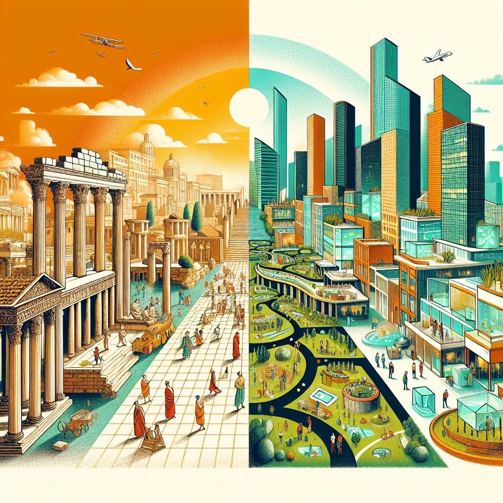
Echoes of the Past, Blueprints for the Future: Historical Urbanism and the Remaking of Cities
TABLE OF CONTENTS
- Executive Summary
- Introduction
- Introduction to Cities and Urban Structure: Framing Historical Contexts for Contemporary Planning
- Historical Foundations of Urban Form: From Antiquity to Industrialization
- Case Studies in Historical Urbanism: Mechanisms and Lessons
- Modern Applications of Historical Principles: Preservation, Innovation, and Smart Integration
- Research Trends and Future Directions: Topic Modeling and Emerging Paradigms
- Conclusion and Strategic Recommendations
- Conclusion
1. Executive Summary
This report examines the profound influence of historical precedents on contemporary urban planning, arguing that understanding past successes and failures is crucial for creating equitable, sustainable, and resilient cities. Analyzing case studies from ancient Greece and Rome to modern-day initiatives in cities like Seoul and Detroit, the report demonstrates how historical urban structures continue to shape modern urban forms and social dynamics.
Key findings reveal that while grid systems have historically promoted equality and order (Hippodamus of Miletus), they can also lead to rigidity and monotony if not adapted to contemporary needs. Haussmann’s Parisian boulevards, while improving sanitation and traffic flow, also resulted in social displacement, highlighting the need for community engagement in urban renewal projects. The integration of historical insights, smart technologies, and adaptive policy frameworks is essential for evidence-based planning, with a focus on enhancing citizen well-being and cultural preservation. The report recommends a synergistic approach that leverages historical knowledge to inform smart-tech deployments and emphasizes the importance of community involvement in shaping urban environments.
2. Introduction
How can the urban environments of antiquity inform the designs of the metropolises of tomorrow? This report explores the dynamic interplay between historical urban planning principles and contemporary urban challenges. From the grid layouts of ancient Miletus to the sweeping boulevards of Haussmann's Paris, history offers a rich tapestry of urban experiments, successes, and failures that continue to resonate in modern cityscapes.
Urban planning, as a discipline, is not simply about erecting buildings or laying down streets; it is about shaping societies, fostering communities, and responding to the evolving needs of human populations. A deep understanding of urban history is paramount for contemporary planners seeking to create equitable, sustainable, and resilient cities. By analyzing historical precedents, we can identify enduring patterns, anticipate unintended consequences, and develop innovative solutions to pressing urban problems.
This report delves into the historical foundations of urban form, examining case studies from ancient civilizations to the Industrial Revolution, and analyzes their modern applications through cultural heritage preservation and smart city retrofits. It also explores current research trends, using topic modeling to identify dominant themes and emerging paradigms shaping the future of urban planning. Ultimately, the report aims to equip graduate students with a framework for integrating historical insights, smart technologies, and adaptive policy frameworks into their planning practices, promoting evidence-based decision-making and enhancing citizen well-being.
3. Introduction to Cities and Urban Structure: Framing Historical Contexts for Contemporary Planning
3-1. Urban Planning Fundamentals and Historical Relevance
This subsection establishes the crucial groundwork for understanding urban planning by highlighting its deep historical roots and their enduring relevance. It introduces key figures like Hippodamus and Haussmann, setting the stage for subsequent sections that delve into specific historical foundations and case studies, ultimately demonstrating how these historical precedents inform contemporary urban challenges and shape modern equity goals.
Hippodamus of Miletus, a 5th-century BC Greek architect and urban planner, is credited with developing the orthogonal grid plan, a radical departure from the organic layouts of earlier cities. This grid system, characterized by straight streets intersecting at right angles, aimed to promote equality and order within the urban environment. However, understanding the true impact of Hippodamus requires going beyond the theoretical framework and examining specific examples and quantifiable metrics.
The grid plan in Miletus, for instance, allocated equal-sized blocks to citizens, fostering a sense of spatial equity. The dimensions of these blocks, typically around 35 x 70 meters, dictated the size and orientation of residential and public buildings, influencing the overall urban form. This contrasted sharply with earlier, more hierarchical urban layouts where proximity to power determined spatial privilege. The strategic implication is that early urban planning consciously used spatial arrangement as a tool for social engineering, setting a precedent for future urban development efforts aimed at promoting equality.
Modern analyses, drawing on ref_idx 94, highlight how Hippodamian grids, while promoting initial equity, can lead to unforeseen challenges. The rigid structure can limit adaptability and create monotonous urban landscapes, potentially hindering social interaction and economic diversity. Today's planners need to understand these trade-offs, applying historical lessons to create grid-based systems that balance order with flexibility. For example, integrating mixed-use zoning and public spaces within the grid can enhance its social and economic resilience, mitigating the potential for spatial segregation and promoting vibrant community life.
Metrics to consider when analyzing Hippodamian-style grids include block size, street width, the ratio of public to private space, and the distribution of essential services across the grid. Analyzing these factors quantitatively allows for a more nuanced understanding of how spatial arrangements influence urban life, paving the way for evidence-based planning decisions. For instance, overlaying ancient Athens' grid (ref_idx 1) with contemporary Seoul's layout helps students grasp the grid's governance logic and compare spatial equity across millennia. Incorporating these quantitative metrics into course curricula can strengthen student understanding of urban spatial dynamics.
Implementation requires that modern planners adapt the grid system to meet contemporary needs. This includes integrating green infrastructure, promoting walkability and bikeability, and ensuring access to affordable housing and public transportation within the grid. Furthermore, incorporating feedback from diverse community stakeholders in the planning process can help tailor the grid to specific local contexts, maximizing its potential to promote equity and sustainability. To create genuinely equitable urban spaces, it is crucial to balance the historical precedent with contemporary best practices.
Baron Georges-Eugène Haussmann's transformation of Paris during the Second Empire (1852-1870) is a defining moment in urban planning history. Commissioned by Napoleon III, Haussmann implemented a series of radical urban renewal projects that reshaped the city's physical and social fabric. However, beneath the aesthetic grandeur of his boulevards lies a complex legacy, marked by both modernization and social disruption.
The scale of Haussmann's interventions was immense. Over two decades, he oversaw the construction of approximately 85 miles (137 kilometers) of new boulevards, often cutting through densely populated neighborhoods. These boulevards, such as Boulevard Haussmann (2.53 km long [ref_idx 179]) and Boulevard Saint-Germain (3.5 km long [ref_idx 181]), dramatically altered the city's spatial organization, improving traffic flow and facilitating military control. They are also lined with apartment blocks whose regulated cornice height gives a pleasing eyeline to the Boulevard [ref_idx 179], which in turn led to a new urban aesthetic.
However, Haussmannization also displaced thousands of working-class residents, demolishing their homes and disrupting their communities. This social upheaval fueled resentment and contributed to the rise of social movements. Moreover, the construction of wide boulevards was strategically designed to prevent barricades, a common tactic employed during urban uprisings. The wide streets were also designed to allow the rapid movement of troops and even artillery inside the city core, to allow the army to swiftly put down any uprising that did occur [ref_idx 174]. This underscores the complex relationship between urban planning and social control, revealing how design choices can reinforce existing power structures.
Modern analyses, drawing on ref_idx 174, emphasize that Haussmann's boulevards served not only as transportation arteries but also as tools for enforcing class boundaries and consolidating capital. Much work was put into regularizing the city, even down to ensuring the regular spacing of trees, further promoting an atmosphere of uniformity and control [ref_idx 174]. Consequently, understanding the lengths, widths, and areas impacted by Haussmann's boulevards is essential for grasping the full scope of his urban transformation and its socio-political consequences. A modern Renault showroom is at 104 boulevard Haussmann as of 2024 [ref_idx 178].
To avoid the pitfalls of Haussmannization, modern planners must prioritize community engagement and social equity. This includes implementing measures to mitigate displacement, preserve affordable housing, and promote inclusive development. Moreover, planners should strive to create public spaces that are accessible to all residents, regardless of their socio-economic status, fostering a sense of belonging and shared citizenship. The creation of the Boulevard de Strasbourg was one of the streets envisaged in conjunction with the new train stations and its special significance was that it could potentially be continued straight toward the city center, forming a major artery into the heart of the city, perpendicular to the Seine [ref_idx 182].
Contemporary urban planning increasingly emphasizes equity and sustainability, drawing lessons from historical precedents and adapting them to address contemporary challenges. To illustrate, the Bus Rapid Transit (BRT) system in Curitiba, Brazil, stands as an example of innovative planning that prioritizes affordable transportation and reduces environmental impact. Additionally, Korea's efforts to develop and preserve heritage networks provide insights into how cultural assets can drive equitable and sustainable urban regeneration.
Curitiba's BRT system, implemented in the 1970s, provides a cost-effective and efficient public transportation alternative, particularly benefiting low-income residents. By prioritizing dedicated bus lanes and integrated fare systems, the BRT significantly reduces travel times and improves access to employment opportunities, healthcare, and education. While lacking perfect implementation, it highlights intentionality. This approach contrasts with car-centric planning models that often exacerbate social inequalities by disproportionately benefiting affluent residents while marginalizing those without access to private vehicles. It is in contrast to master plans with transportation planning exclusively for motorized vehicles [ref_idx 103].
Korea's heritage networks, as outlined in ref_idx 6 and 9, demonstrate how cultural assets can be leveraged to promote equitable urban development. By strategically connecting historical sites, museums, and cultural institutions, these networks not only preserve cultural heritage but also stimulate economic activity and enhance community pride. However, ensuring that the benefits of heritage-led regeneration are distributed equitably requires careful planning and community engagement. Ref_idx 78 warns about the need for careful planning and community engagement.
In both Curitiba and Korea, success hinges on addressing potential challenges. For instance, BRT systems can face issues related to overcrowding, accessibility for disabled passengers, and integration with other modes of transportation. Similarly, heritage-led regeneration initiatives must guard against gentrification and ensure that local residents benefit from increased tourism and economic activity. Furthermore, as new cities like Sejong embed symbolic elements, citizen place perception becomes critical [ref_idx 20, 88, 80].
Implementing equity-focused planning requires a multi-faceted approach. This includes conducting thorough socio-economic analyses to identify the needs and priorities of diverse community stakeholders, developing targeted policies to address social inequalities, and establishing robust monitoring and evaluation frameworks to assess the impact of planning interventions. By learning from both historical successes and failures, urban planners can create more equitable, sustainable, and resilient cities for all.
3-2. Pedagogical Framework for Active Learning
This subsection addresses the active learning and research skill development aspects of the course. It transitions from laying the groundwork of urban planning and history to detailing specific pedagogical methodologies, particularly the S-T-W framework, to enhance students' analytical capabilities. This sets the stage for subsequent sections which will apply these methodologies in case studies and research applications.
The See-Think-Wonder (S-T-W) framework, detailed in ref_idx 8, offers a structured approach to visual analysis, encouraging students to observe, interpret, and question urban environments. In urban history education, this framework moves beyond rote memorization, promoting critical engagement with historical texts and visual sources like maps, photographs, and architectural plans. However, applying S-T-W effectively requires tailored examples relevant to graduate-level coursework.
A practical application of S-T-W involves dissecting the evolution of a city's street grid. For example, students could analyze historical maps of Paris, using 'See' to note the changing street patterns over centuries, 'Think' to hypothesize about the social and economic drivers behind these changes (e.g., Haussmann's reforms ref_idx 174), and 'Wonder' to question the long-term impacts of these transformations on urban life and social equity. This exercise fosters a deeper understanding of how historical forces shape urban morphology, transitioning analysis beyond aesthetics and into complex historical and social understanding.
Consider also the case of Seoul's urban development. Students can use S-T-W to analyze the city's transformation from a traditional Joseon-era capital to a modern metropolis. 'See' might involve identifying traditional hanoks alongside modern skyscrapers, 'Think' about the competing pressures of preservation and development, and 'Wonder' about the future of Seoul's urban identity in the face of globalization. Ref_idx 8’s core activity sheets can then be modified to suit graduate-level discussions about policy tensions. Moreover, ref_idx 25’s tips for lecture selection, such as prioritizing professors with positive teaching evaluations, can guide students toward modules that effectively integrate S-T-W in urban history.
Metrics for assessing the success of S-T-W include the depth and complexity of student questions ('Wonder' stage), the accuracy and nuance of their interpretations ('Think' stage), and the thoroughness of their observations ('See' stage). Instructors should encourage students to move beyond surface-level observations, prompting them to consider the social, economic, and political contexts that shape urban environments. This can involve scaffolding activities, providing guiding questions, and fostering a classroom culture of intellectual curiosity.
Implementing S-T-W requires intentional design and facilitation. Instructors must select visual sources that are rich in historical information and relevant to course themes. They should also model the S-T-W process, demonstrating how to move from simple observations to insightful questions and interpretations. Furthermore, instructors should provide opportunities for students to share their S-T-W analyses, fostering a collaborative learning environment where students can learn from each other's perspectives. These collaborative approaches align with active and social learning models which engage “learners emotionally and cognitively in the education process” (ref_idx 435).
Active learning strategies are essential for engaging graduate students in urban morphology, particularly when analyzing complex historical cases. These strategies move beyond passive listening, encouraging students to actively construct knowledge through discussion, problem-solving, and visual analysis. Practical examples include using case studies, simulations, and collaborative projects to explore urban development, regeneration, and sustainability.
A key active learning exercise involves comparing and contrasting the urban morphology of different cities, such as Seoul and Paris. Students can analyze historical maps, architectural plans, and photographic evidence to identify similarities and differences in street layouts, building types, and public spaces. They can then research the historical, social, and economic factors that shaped these morphological patterns, drawing connections to key urban planning theories and principles. These analytical exercises are designed to enhance critical thinking, connecting abstract methodology with ready-to-use case studies (ref_idx 445).
Furthermore, students can engage in 'urban acupuncture' exercises, where they identify small-scale interventions that could improve the functionality and livability of specific urban areas. For example, students could propose strategies for revitalizing a neglected public space, improving pedestrian access, or integrating green infrastructure into a dense urban neighborhood. These activities require students to apply their knowledge of urban morphology to real-world problems, fostering creativity and problem-solving skills. Case studies from successful co-op programs show that ‘real-world training’ and employability skills such as communication, problem solving, and leadership are enhanced as well (ref_idx 382).
To assess the effectiveness of active learning, instructors can use a variety of methods, including group presentations, research papers, and design projects. These assessments should evaluate students' ability to apply urban morphology concepts to specific cases, analyze the historical and social forces that shape urban environments, and propose innovative solutions to urban problems. Crucially, students should practice language skills as they work on the challenges (ref_idx 377).
Successful implementation of active learning requires careful planning and facilitation. Instructors must select cases and exercises that are relevant to course themes and aligned with student learning objectives. They should also provide clear guidelines and expectations, fostering a supportive and collaborative learning environment where students feel comfortable taking risks and experimenting with new ideas. These approaches should be tied to ongoing and completed project work to ensure effective visual analyses (ref_idx 8).
4. Historical Foundations of Urban Form: From Antiquity to Industrialization
4-1. Ancient Civilizations: Hippodamus, Forums, and Civic Identity
This subsection explores the historical roots of urban planning, specifically focusing on ancient Greek and Roman civilizations. It sets the stage for later sections by examining how early planning principles, such as the grid system, established foundational elements still relevant in contemporary urban design. The subsection connects directly to the introduction by illustrating early applications of urban planning theories and prepares the reader for subsequent case studies by providing historical context.
Hippodamus of Miletus, often dubbed the 'father of European urban planning' (ref_idx 127), pioneered the grid plan as a means to impose rational social order on urban spaces. Miletus, rebuilt after its destruction by the Persians in 494 BC, exemplifies this approach (ref_idx 133). This contrasts sharply with the organic, often chaotic development patterns seen in earlier cities, presenting a deliberate shift towards planned urban environments.
The core mechanism involves dividing the city into regular blocks intersected by perpendicular streets. This orthogonal layout facilitated efficient resource allocation, standardized building plots, and simplified navigation. However, Aristotle critiqued Hippodamus' plans, arguing that a rigid grid could lead to social and political inflexibility (ref_idx 135). The tension between order and adaptability remains a central debate in urban planning to this day.
The Miletus grid served as a template for subsequent Greek and Roman cities, demonstrating its enduring influence. Rhodes and Piraeus also employed Hippodamian plans (ref_idx 129, 130), further solidifying its place in urban design history. The Commissioners' Plan of 1811 for New York City, with its unwavering grid, echoes this ancient influence, albeit on a vastly different scale.
For urban planners, the legacy of Hippodamus underscores the importance of balancing order with flexibility. While the grid provides a framework for efficiency and equality, it can also stifle creativity and community identity. Modern applications require careful consideration of local context and social needs.
We recommend integrating historical context, especially regarding the trade-offs inherent in grid planning, into contemporary design curricula. Students should analyze both the benefits and drawbacks of orthogonal layouts, learning to adapt this ancient system to modern challenges.
Roman cities, while often employing the grid, placed particular emphasis on axial planning, particularly within the forum. The forum served as the civic, religious, and commercial heart of the city, embodying Rome's power and organizational capabilities. Axiality, defined by dominant central axes, was used to direct movement, frame key monuments, and reinforce social hierarchies.
The core mechanism involves a central axis, typically aligned with major temples or public buildings, creating a visual and symbolic hierarchy. The Roman Forum, expanded and modified over centuries, illustrates this principle (ref_idx 206). The Via Sacra, the main processional route, bisects the forum, culminating at the Temple of Jupiter on the Capitoline Hill. This deliberate arrangement reinforced Rome’s authority and religious beliefs.
Trajan's Forum, measuring 300 meters on a north-south axis and 180 meters east to west, exemplifies the scale and ambition of Roman axial planning (ref_idx 205). The Basilica Ulpia, Trajan's Column, and the Temple of Trajan were carefully positioned along this axis, creating a unified and imposing civic space. Even within the grid, axial emphasis created focal points.
Modern urban design can draw lessons from Roman axiality in creating meaningful public spaces. The strategic placement of monuments, the careful control of vistas, and the use of processional routes can all contribute to a sense of civic pride and community identity.
We recommend that urban designers analyze successful examples of axial planning, both historical and contemporary, to understand how they shape public perception and social interaction. This analysis should inform the design of modern civic centers and public spaces.
Understanding the dimensions and layout of ancient cities requires familiarity with their measurement systems. The Romans, for example, employed a range of units, including the digitus (finger width), palmus (palm width), pes (foot), and passus (pace). These units, based on human anatomy, provide insights into the scale and proportions of Roman architecture.
The core mechanism involves understanding the relationships between different units and how they were applied in practical surveying. The Roman foot, equivalent to approximately 29.6 cm (ref_idx 207, 209), served as a fundamental building block. Surveyors used tools like the groma for establishing right angles and the decempeda (10-foot rod) for measuring distances (ref_idx 213).
Analysis of Pompeii and Herculaneum reveals the application of these measurement systems in urban layouts. Herculaneum, built according to the standard model of Hippodamus of Miletus with a grid of crossing Decumans and Cardos (ref_idx 132), demonstrates consistent application of Roman units. These cities provide tangible evidence of practical geometry in action.
Modern urban planners can use historical measurement systems to better understand the design intentions of ancient architects. Analyzing the dimensions of buildings and urban spaces in their original units can reveal subtle proportional relationships often lost in modern conversions.
We recommend incorporating historical measurement systems into urban planning curricula. Students should be trained to interpret ancient plans and architectural drawings using original units, enhancing their understanding of design principles and construction techniques.
4-2. Medieval Cityscapes: Bazaars, Squares, and Organic Growth
Following the examination of ancient urban forms, this subsection delves into the medieval period, comparing the spatial organization of Islamic and European cities. It assesses how these historical layouts inform modern placemaking strategies, setting the foundation for understanding the evolution of urban design principles.
Medieval Islamic cities like Istanbul developed distinct commercial centers known as suqs, characterized by their organic layouts and vibrant commercial activity. Unlike the planned grids of Roman cities, suqs evolved incrementally, adapting to local conditions and social needs, creating complex networks of interconnected spaces.
The core mechanism involves the clustering of specialized trades along narrow, winding streets, fostering intense social interaction and economic exchange. Istanbul's Grand Bazaar (Kapalıçarşı) exemplifies this pattern, with its labyrinthine corridors housing thousands of shops, workshops, and cafes. The bazaar’s dimensions are not explicitly provided in the reference documents, but its layout can be inferred to be irregular and adaptive, reflecting its organic growth over centuries, unlike planned dimensions of orthogonal planned settlements (ref_idx 271).
Historical accounts and architectural analyses reveal that suqs were not merely commercial spaces but also vital social hubs. They featured mosques, bathhouses, and public fountains, integrating religious, hygienic, and recreational functions into the commercial fabric. This holistic approach contrasts with the more segregated zoning practices of modern urban planning.
Modern urban designers can draw inspiration from the suq's integrated approach to placemaking, creating mixed-use districts that foster social interaction and economic vitality. Adaptive reuse of historic suq structures can also preserve cultural heritage while accommodating contemporary needs.
We recommend integrating the principles of suq design into urban revitalization projects, prioritizing pedestrian-friendly environments, mixed-use development, and the integration of cultural amenities.
In contrast to the organic layouts of Islamic suqs, European medieval cities, particularly those in Italy, often featured carefully planned public squares or piazzas. These spaces served as civic, social, and religious centers, embodying the ideals of Renaissance humanism and civic pride.
The core mechanism involves the deliberate arrangement of buildings around a central open space, creating a focal point for public life. Florence's Piazza della Signoria exemplifies this principle, with its iconic Palazzo Vecchio, Uffizi Gallery, and Loggia dei Lanzi framing a vibrant public arena. The piazza's spatial arrangement reflects the city's political and cultural aspirations.
Historical sources and urban analyses reveal that piazzas were not merely aesthetic spaces but also vital centers of political and social activity. They hosted public assemblies, festivals, and markets, fostering a sense of civic identity and collective belonging. Piazza della Signoria, with its sculptures and monuments, served as a stage for Florentine civic life.
Modern urban planners can learn from the design of Italian piazzas, creating public spaces that encourage social interaction and civic engagement. The strategic placement of monuments, the careful control of vistas, and the provision of public amenities can all contribute to a sense of place and community.
We recommend that urban designers study successful examples of Italian piazzas, both historical and contemporary, to understand how they shape public perception and social interaction. This analysis should inform the design of modern civic centers and public spaces.
Beyond individual sites, the concept of cultural routes highlights the interconnectedness of medieval cities and regions. These routes facilitated the exchange of goods, ideas, and cultural practices, shaping the spatial and social landscape of medieval Europe and the Middle East.
The core mechanism involves the establishment of linear corridors that link significant historical sites, fostering a sense of shared heritage and regional identity. The Silk Road, connecting East and West, exemplifies this principle, facilitating the exchange of goods, technologies, and religious beliefs across vast distances.
Historical research reveals that cultural routes were not merely conduits of trade but also catalysts for cultural diffusion and innovation. They facilitated the spread of architectural styles, artistic techniques, and intellectual ideas, enriching the cultural landscape of medieval Eurasia.
Modern heritage conservation efforts can draw inspiration from the concept of cultural routes, promoting the preservation and interpretation of interconnected historical sites. These routes can also serve as catalysts for tourism and economic development, fostering a sense of regional identity and cultural pride.
We recommend that heritage managers and urban planners collaborate to identify and promote cultural routes, connecting historical sites, fostering sustainable tourism, and celebrating shared cultural heritage.
4-3. Industrial Era Reforms: Sanitation, Housing, and Grids
Following the exploration of medieval urban characteristics, this subsection analyzes the impact of the Industrial Revolution on urban form, focusing on sanitation crises, housing shortages, and the imposition of grids. It links back to previous sections by examining how historical planning failures necessitated reform and sets the stage for future sections that discuss modern applications of lessons learned from this era.
The Industrial Revolution brought rapid urbanization and unprecedented population density, particularly in cities like Manchester. This influx strained existing infrastructure, leading to severe sanitation problems and widespread disease. The Oxford Plan (ref_idx 427, multiple entries), although not explicitly described in provided references regarding grid spacing, reflects the era's attempt to manage growth through grid expansion, albeit often failing to address the underlying issues of poverty and sanitation.
The core mechanism involved extending the existing urban grid to accommodate new industries and housing, aiming for orderly expansion. However, the lack of adequate sanitation systems and the overcrowding of housing led to the proliferation of diseases such as cholera and typhoid. The rapid expansion also outstripped the ability to provide essential services, exacerbating social inequality and public health crises. It's notable that a Siemens study considered making the Oxford Road Corridor a 'Smart Corridor' for energy independence (ref_idx 428), highlighting ongoing efforts to address industrial legacy.
Manchester's experience serves as a cautionary tale for modern urban planners. While the grid provided a framework for expansion, it failed to address the root causes of urban blight. The focus on industrial productivity overshadowed the need for social welfare and public health infrastructure. The strategic regeneration framework guidance (ref_idx 427, multiple entries) implies efforts to rectify past planning failures.
Modern urban planners must prioritize public health and social equity alongside economic development. Grid planning should be complemented by investments in sanitation, affordable housing, and access to essential services. Ignoring these factors can lead to the creation of new slums and perpetuate cycles of poverty and disease.
We recommend conducting comprehensive social impact assessments before implementing urban expansion plans. These assessments should identify vulnerable populations and ensure that their needs are addressed in planning and development processes. Lessons from the Oxford Plan highlight the importance of integrating social and environmental considerations into urban planning.
Baron Haussmann's transformation of Paris in the mid-19th century represents a radical approach to urban planning driven by both sanitary and social control objectives. The creation of wide boulevards and the demolition of dense, unsanitary neighborhoods were intended to improve public health and facilitate troop movement to suppress potential uprisings (ref_idx 499, 500, 501).
The core mechanism involved replacing narrow, winding streets with broad avenues, improving air circulation and access to sunlight, which were believed to reduce the spread of disease (ref_idx 499, 500, 501, 504). Simultaneously, these boulevards allowed for rapid troop deployment, suppressing dissent and preventing barricades, as mentioned in multiple sources. This dual purpose reflects the complex motivations behind Haussmann's urban interventions, indicating a shift from medieval urban planning towards urban planning targeting public health and social stability.
The construction of Boulevard Haussmann (ref_idx 177, 179) and Boulevard Saint-Michel (ref_idx 180) exemplifies this approach. These boulevards not only improved traffic flow but also created visual axes that showcased the power and grandeur of the Second Empire. However, they also displaced working-class populations and contributed to social segregation, as highlighted by urban historians (ref_idx 172, 174).
Modern urban planners must consider the social and political implications of large-scale urban renewal projects. While improving infrastructure and public health is essential, displacement and social fragmentation can have lasting negative consequences. A balance between improving urban infrastructure and preserving local communities is needed.
We recommend conducting thorough community consultations before implementing urban renewal projects. These consultations should ensure that residents are informed about the potential impacts of the project and have a meaningful opportunity to shape its design and implementation. Incorporating historical context, as suggested by the initial lecture plan (ref_idx 1), will enhance students' understanding of planning decisions.
5. Case Studies in Historical Urbanism: Mechanisms and Lessons
5-1. Athens and Rome: Grids as Democratic and Imperial Symbols
This subsection examines the historical application of grid systems in ancient Athens and Rome, analyzing how these layouts served as symbols of governance and civic engagement. It bridges historical urban planning principles with contemporary practices, specifically drawing parallels to modern grid-based master plans, including Seoul's.
Hippodamus of Miletus, often dubbed the 'Father of European Urban Planning' (ref_idx 127, 129, 131), advocated for orthogonal grid systems as tools for embodying rational social order (ref_idx 127). His design for Miletus featured a rectilinear grid centered on the agora, promoting civic engagement and democratic ideals (ref_idx 129). The grid wasn't simply spatial organization; it was a deliberate attempt to materialize societal values.
The core mechanism at play is the democratization of space through equal divisions. Grids facilitate equitable access and distribution of resources and opportunities. By imposing order and regularity, they aimed to eliminate spatial hierarchies and promote social cohesion. While Hippodamus' contributions are recognized, grid-based planning predates him, suggesting a broader understanding of its utility.
Athens provides a contrasting example where spontaneous urbanization resulted in a largely disorganized urban layout (ref_idx 124), however the agora and acropolis were carefully planned (ref_idx 124, 134). This contrasts with the planned grid of Miletus and later Roman cities (ref_idx 131, 133). Piraeus, the port of Athens, was rebuilt according to Hippodamian principles, highlighting its functional and symbolic value (ref_idx 136). The Commissioners' Plan of 1811 for New York City further demonstrates the enduring influence of grid systems in shaping urban expansion (ref_idx 129).
The strategic implication is that urban grids can be consciously employed to signal democratic values and encourage civic participation. However, grids are not inherently democratic; their socio-political effects are contingent on how they are implemented and managed. Furthermore, Seoul is divided into a grid of administrative districts, managed by the Seoul Metropolitan Government (ref_idx 221).
For contemporary urban planners, analyzing Seoul's urban grids through the lens of Hippodamian principles can offer critical insights into promoting inclusivity. We recommend conducting community workshops to solicit feedback on how grid layouts influence social interactions and spatial equity. Planners should use GIS tools to analyze accessibility and connectivity within Seoul's grid system, identifying areas where improvements can enhance civic engagement.
In contrast to the democratic underpinnings of some Greek cities, the Roman Empire utilized grids as tools for asserting control, facilitating military efficiency, and standardizing urban development (ref_idx 131, 133). Roman colonia, or settlements, typically imposed a rigid orthogonal grid pattern with cardines (north-south axes) and decumani (east-west axes) (ref_idx 131). These grids simplified administration, logistics, and defense.
The core mechanism here involves spatial standardization for imperial objectives. Grids enabled efficient allocation of land, resources, and infrastructure, streamlining the empire's administrative and military operations. This facilitated rapid urbanization and the projection of Roman power across vast territories. Each conquered territory was planned using familiar, Roman layouts.
Pompeii stands as a well-preserved example of Roman urban planning using the gridiron system (ref_idx 129). Other colonia across the Roman Empire showcased similar grid patterns, emphasizing uniformity and control. Modern administrative cities like Sejong in South Korea also employ grid-based layouts (ref_idx 20). These layouts facilitate efficient transportation and resource management, but they also raise questions about cultural identity and place perception.
The strategic implication is that urban grids can serve as powerful instruments for consolidating authority and promoting uniformity. However, this can come at the expense of local identity and cultural distinctiveness. Understanding the trade-offs between efficiency and cultural preservation is crucial for modern planners.
We recommend analyzing the social impacts of grid-based planning in administrative cities like Sejong. Planners should conduct surveys to assess residents' perceptions of place identity and social cohesion. Incorporating elements of local culture and history into the urban fabric can mitigate the homogenizing effects of grid systems. Also, new methods have emerged for city planning, using software to perform layered modelling of cities (ref_idx 215).
5-2. Istanbul's Süleymaniye: Integrating Mosque, Bazaar, and Bath
This subsection explores the Süleymaniye complex in Istanbul as a prime example of integrated urban design, where religious, commercial, and social functions are interwoven to create a holistic social system. It aims to decode the spatial syntax and functional integration of the complex, providing insights for contemporary mixed-use design and urban revitalization projects.
The Süleymaniye complex, constructed between 1551 and 1558 under Süleyman the Magnificent, represents a pinnacle of Ottoman architectural and social planning (ref_idx 358, 363). Designed by the renowned architect Sinan, it integrates a mosque (Süleymaniye Mosque), a bazaar, a bath (hammam), a hospital, a library, and several schools, forming a self-contained community hub (ref_idx 357, 366). The integration wasn't merely spatial; it was a deliberate effort to foster social cohesion and economic vitality.
The core mechanism lies in the synergistic relationship between the various components. The mosque provided spiritual guidance, the bazaar facilitated economic exchange, the hammam offered physical cleansing and social interaction, and the schools ensured intellectual development (ref_idx 366). This multi-functional design created a vibrant urban ecosystem where different aspects of life were interconnected and mutually reinforcing. The layout encouraged daily interactions and strengthened community bonds.
The Süleymaniye Hamami, a mixed-gender Turkish bath within the complex, exemplifies this integration (ref_idx 356). It provided a space for relaxation, hygiene, and social gathering, catering to diverse needs within the community. Historical accounts and architectural plans reveal the intricate layout of the complex, demonstrating how each element was carefully positioned to maximize its functionality and accessibility (ref_idx 358, 363). Even today, the complex remains a focal point of Istanbul, attracting visitors and locals alike.
Strategically, the Süleymaniye complex showcases the power of integrated urban design in creating sustainable and resilient communities. By combining essential functions within a compact and accessible space, it minimized travel distances, promoted social interaction, and enhanced the overall quality of life. This approach offers valuable lessons for contemporary urban planners seeking to create vibrant and inclusive neighborhoods.
We recommend analyzing modern mixed-use developments through the lens of the Süleymaniye complex. Planners should prioritize the integration of diverse functions, such as housing, commerce, recreation, and social services, within a walkable and well-connected environment. Furthermore, incorporating elements of local culture and history into the design can enhance the sense of place and community identity. Urban planning strategies could learn from this example by including green spaces and communal areas in future project designs (ref_idx 27).
Spatial syntax, a set of theories and techniques for analyzing spatial configurations, offers a powerful lens for understanding the Süleymaniye complex's integrated design (ref_idx 329). By mapping the complex's layout and analyzing the connectivity between its various components, we can gain insights into how its spatial organization facilitates social interaction and functional integration.
The core mechanism involves analyzing the axial lines and visibility graphs within the complex. Key measures include integration (how accessible a space is from all other spaces), control (how well a space controls access to other spaces), and connectivity (the number of direct connections a space has). High integration values indicate central and easily accessible spaces, while high control values suggest strategic locations that regulate movement within the complex.
Detailed architectural plans of the Süleymaniye complex are essential for conducting a spatial syntax analysis. These plans reveal the strategic placement of key components, such as the mosque, bazaar, and hammam, along highly integrated axial lines (ref_idx 363). The spatial layout encourages pedestrian movement between these areas, fostering social interaction and economic exchange. The clustering of related functions, such as schools and libraries near the mosque, further reinforces the complex's integrated character.
The strategic implication is that spatial syntax analysis can inform the design of contemporary mixed-use developments. By optimizing the layout to enhance connectivity and accessibility, planners can create vibrant and integrated urban spaces that promote social cohesion and economic activity. Understanding how different spatial configurations influence human behavior is crucial for creating successful urban environments.
We recommend utilizing spatial syntax software to analyze the connectivity and integration patterns of the Süleymaniye complex. Planners should use the findings to inform the design of contemporary mixed-use developments, prioritizing the creation of accessible and interconnected spaces that foster social interaction and economic activity. Applying green building and design standards could increase the overall sustainability of such a project (ref_idx 27).
5-3. Shanghai's French Concession: Colonial Layering and Adaptive Reuse
This subsection delves into Shanghai's French Concession, scrutinizing how its colonial history has shaped layered identities and informing modern adaptive reuse projects in post-industrial contexts. It bridges historical spatial planning with contemporary urban revitalization strategies.
The Shanghai French Concession, established in 1849 and lasting until 1943, stands as a compelling case study in colonial urban planning (ref_idx 449, 450). Its street network, characterized by tree-lined boulevards and a more organic layout compared to the grid-like International Settlement, reflects a distinct aesthetic and planning philosophy (ref_idx 450). This spatial configuration shaped social interactions and economic activities within the concession, creating a unique urban environment.
The core mechanism involves the imposition of a European urban model onto an existing Chinese context. The French consciously designed the concession to evoke a sense of familiarity and comfort for its European residents, while also facilitating efficient administration and control. This layering of cultures resulted in a hybrid urban landscape, where Western architectural styles coexisted with traditional Chinese forms.
Hengshan Road, formerly Avenue Petain, exemplifies the French influence with its mansions and apartment blocks built in the 1920s and 1930s (ref_idx 450). The road's transformation into a nightlife hub in the 1990s demonstrates the adaptive capacity of the street network to accommodate changing social and economic needs (ref_idx 450). Furthermore, the presence of "CMF" (Conseil Municipal Français) manhole entrances near Hengshan Road serves as a physical reminder of the French administration (ref_idx 450). The extra-settlement roads concept demonstrates the administrative reach beyond the formal boundaries of the concession (ref_idx 454).
The strategic implication is that colonial urban planning leaves a lasting spatial legacy that continues to shape urban life. Understanding the historical context of street networks is crucial for contemporary urban planners seeking to revitalize and adapt these areas. Moreover, recognizing the power dynamics embedded in colonial planning can inform more equitable and inclusive urban design practices.
We recommend conducting GIS analysis of the French Concession's street network to quantify its spatial characteristics and compare it to other parts of Shanghai. Planners should also investigate the social and economic impacts of the street network on different communities within the concession, identifying opportunities to promote greater accessibility and connectivity. Preserving existing colonial infrastructure is recommended (ref_idx 450).
The Shanghai French Concession has undergone significant adaptive reuse, transforming former residential and commercial buildings into modern spaces while preserving their historical character (ref_idx 479, 481). This process involves repurposing existing structures to meet contemporary needs, such as converting mansions into bars and restaurants or transforming industrial sites into cultural hubs (ref_idx 450). Adaptive reuse offers a sustainable approach to urban development, reducing demolition waste and preserving architectural heritage.
The core mechanism at play is the reinterpretation of existing spaces to accommodate new functions. This requires a careful balancing act between preserving historical elements and adapting the building to meet modern standards of comfort and functionality. Successful adaptive reuse projects often involve creative design solutions that integrate old and new, celebrating the building's history while providing a contemporary experience.
Yong Ping Li, an ANKEN urban regeneration project near Hengshan Road, exemplifies adaptive reuse by transforming a 6,000 sqm compound into a mixed-use development (ref_idx 450). The conversion of former mansions into bars and nightclubs along Hengshan Road showcases the adaptive capacity of these buildings to accommodate changing social and economic trends (ref_idx 450). Other cities in China have similar processes (ref_idx 481).
The strategic implication is that adaptive reuse can be a powerful tool for revitalizing historic districts and promoting sustainable urban development. However, it requires a sensitive approach that respects the building's historical character and addresses the needs of the local community.
We recommend developing a comprehensive adaptive reuse strategy for the French Concession that prioritizes the preservation of significant historical buildings and promotes community engagement. Planners should offer incentives for developers to incorporate sustainable design principles into their adaptive reuse projects, minimizing environmental impact and maximizing energy efficiency. Furthermore, community workshops could solicit feedback on how the spatial layouts could be improved.
Understanding the community's perception of place is crucial for successful urban revitalization. Analyzing place perception involves assessing how residents and visitors experience and value the unique character of a particular area (ref_idx 80). This includes understanding their emotional connections to the place, their sense of belonging, and their perceptions of safety, accessibility, and attractiveness.
The core mechanism lies in the interplay between the built environment and human experience. Physical attributes of a place, such as architectural style, street layout, and public spaces, influence people's perceptions and behaviors. Social and cultural factors, such as community identity, historical narratives, and personal experiences, also shape place perception.
Research on citizen place perception in new administrative cities like Sejong, South Korea (ref_idx 80) demonstrates the importance of incorporating elements of local culture and history into the urban fabric to foster a sense of place identity and social cohesion. While ref_idx 80 focuses on Sejong, the principles apply to Shanghai's French Concession as well.
The strategic implication is that urban revitalization projects should be designed to enhance the positive aspects of place perception and address any negative perceptions. This requires a participatory approach that involves engaging with the local community to understand their needs and preferences. In the modern day, US cities are trying to use this paradigm, too (ref_idx 75).
We recommend conducting surveys and interviews with residents and visitors to assess their perceptions of the French Concession. Planners should use this feedback to inform the design of revitalization projects, prioritizing the preservation of historical landmarks and the creation of vibrant public spaces. They should also implement community-based initiatives to promote social interaction and cultural exchange, strengthening the sense of belonging and identity within the French Concession.
6. Modern Applications of Historical Principles: Preservation, Innovation, and Smart Integration
6-1. Heritage-led Regeneration: From Kyoto to Detroit
This subsection delves into the practical application of historical awareness by examining heritage-led regeneration strategies. It builds upon the previous section's foundational understanding of urban planning history and sets the stage for modern applications of these principles, specifically focusing on how preserving cultural assets can drive economic and social renewal. The analysis shifts the focus to actionable strategies and real-world case studies.
While UNESCO World Heritage status can significantly boost tourism and investment in heritage sites, the nomination process can face criticisms of being overly bureaucratic, politically influenced, and potentially misaligned with local community needs. In Korea, the pursuit of UNESCO recognition for sites like the Gaya Tumuli burial mounds (ref_idx 118) can overshadow the importance of preserving intangible heritage and fostering genuine community engagement (ref_idx 6, 9).
The tension arises from the prioritization of tangible, monumental heritage that fits UNESCO's standardized criteria, often at the expense of the living traditions and everyday practices that constitute a community's cultural identity. This can lead to a disconnect where the 'universal value' recognized by UNESCO doesn't fully resonate with the local values and historical narratives cherished by the community (ref_idx 9). This prioritization can impact community-led preservation efforts and divert funds.
The inscription of Hiroshima Peace Memorial (ref_idx 114) showcases conflicts between member states which can impede value interpretation. Analysis of the Sado mines case (ref_idx 120), where Japan's UNESCO bid faced opposition from Korea due to the site's association with forced labor, exemplifies the complexities of historical narratives and political sensitivities in heritage nominations. Similarly, the Murujuga Cultural Landscape in Western Australia (ref_idx 116) highlights the conflict between industrial development and the preservation of ancient rock art, underscoring the need for robust environmental safeguards and community consultation during the nomination process.
To mitigate these challenges, Korean heritage management should emphasize participatory approaches that involve local communities in all stages of the nomination process, ensuring that their voices and perspectives are central to defining the site's significance. More balanced approach is needed so that the tangible sites reflect intangible cultural heritage.
Recommendations include establishing a national advisory board comprised of community representatives, academics, and heritage professionals to evaluate UNESCO nominations based on their alignment with local cultural values and sustainability goals. Policy changes should also include flexible funding mechanisms that support community-led heritage initiatives alongside formal UNESCO recognition efforts, and prioritize cultural tourism.
Detroit, once an industrial powerhouse, faced significant decline in the late 20th century. However, recent efforts to revitalize the city have emphasized heritage-led regeneration, leveraging its rich architectural history and cultural assets to drive economic and social renewal. This approach recognizes that preserving Detroit's unique character is not just about nostalgia, but about creating a vibrant and attractive environment for residents, businesses, and visitors (ref_idx 144, 151).
The core mechanism involves attracting investment through the preservation and adaptive reuse of historic buildings, turning them into cultural venues, creative workspaces, and unique residential properties. This strategy builds on the concept that 'restoration and rehabilitation projects not only create better quality jobs and increase the value of buildings but also help to nurture urban redevelopment and related small businesses' (ref_idx 144). These efforts help foster urban redevelopment and related small businesses.
Detroit showcases urban shrinkage extending from the east side of Detroit to cities like Southfield and Dearborn Heights (ref_idx 143). However, heritage-led regeneration can stem this tide and create urban cultural spaces. Bedrock's 14-acre life science-focused innovation district is set to open in 2027, and Henry Ford Health has a $1.5 billion campus expansion (ref_idx 149). The city's Eastern Market area shows the urban regeneration (ref_idx 151), while also improving the social environment.
The strategic implication is that heritage-led regeneration can be a powerful tool for reversing urban decline and fostering sustainable development in post-industrial cities. By carefully curating and celebrating their unique cultural heritage, cities like Detroit can attract investment, create jobs, and enhance the quality of life for their residents.
Recommendations for Detroit include implementing a comprehensive set of metrics to track the economic and social impacts of heritage regeneration projects, including job creation, property value increases, tourism revenue, and community satisfaction. The city should invest in workforce development programs to train local residents in historic preservation skills, ensuring that they benefit directly from the revitalization efforts. By focusing on metrics and local residents, it ensures that the city can sustainably regenerate.
6-2. Administrative New Cities: Crafting Identity Without History
This subsection builds on the previous discussion of heritage-led regeneration by shifting focus to administrative new cities. These urban centers, often planned from scratch, face the unique challenge of establishing a distinct identity without the organic historical development found in older cities. The analysis explores how these cities, particularly Sejong, attempt to embed symbolic elements and shape citizen perceptions of place.
Sejong, as a planned administrative city, strategically incorporates public art to cultivate a sense of place and identity. However, simply installing artworks is insufficient; the success hinges on how effectively these pieces communicate intended symbolic meanings and resonate with citizen perceptions. This goes beyond mere aesthetics to consider the artwork's role in fostering community engagement and reinforcing the city's vision.
Public art in Sejong aims to instill a unique identity, often drawing inspiration from Korean history and culture (ref_idx 20). This contrasts with approaches in cities like Brasilia, mentioned in ref_idx 354, where architectural design served as the primary symbolic language. In Sejong, the deliberate placement and thematic selection of artworks is critical, but also may result in citizen unacceptance due to conflicting ideals or negative perceptions (ref_idx 80).
While a comprehensive list of Sejong's public art projects is not available within the provided documents, analyzing examples like the King Sejong statue (mentioned in ref_idx 278 in relation to a contest win) provides insight. The statue is symbolic and may engage citizens with Korean history; the success lies in its physical placement to align the statue with citizen awareness. Other cities in Korea also promote aesthetics through art campaigns (ref_idx 281).
Strategic implication: Sejong must move beyond symbolic gestures and implement a participatory approach to public art selection and placement. This includes actively soliciting citizen feedback and incorporating local narratives into the design process. Ref_idx 80 highlights the importance of understanding citizen place perception, which should inform the artistic direction of the city.
Recommendations include establishing citizen advisory committees to oversee public art initiatives, conducting pre- and post-installation surveys to gauge public response, and integrating art education programs to foster appreciation for Sejong's cultural identity.
Sejong's urban layout is designed with intention, embedding symbolic elements intended to shape citizen behavior and create a distinct urban identity. Understanding the underlying design principles and how they translate into lived experiences is crucial for evaluating the city's success in crafting a sense of place.
The city's master plan (ref_idx 20) reveals an intentional structure, including sector allocation and spatial arrangement of key facilities. The placement of the National Assembly site, highlighted in ref_idx 353 and 354, underscores Sejong's ambition to become the administrative capital. The spatial relationship between government buildings, residential areas, and green spaces is not arbitrary but designed to foster specific social interactions and reinforce the city's operational logic.
Analyzing Sejong's layout through the lens of citizen perception (ref_idx 80) is important. This includes mapping how citizens navigate the city, which routes they prefer, and what landmarks hold significance. This spatial behavior data reveals the perceived importance of certain symbolic layout in Sejong. Moreover, the placement of green spaces may have varying reactions of citizens from an administrative space.
Strategic implications: Planners should analyze the effectiveness of Sejong's symbolic layout by correlating design elements with citizen behavior and place perception. This may reveal unintended consequences or areas where the layout fails to achieve its intended purpose. More emphasis should be made on community feedback to improve Sejong's structure.
Recommendations include conducting spatial analysis studies to assess pedestrian and vehicular traffic patterns, employing ethnographic research methods to understand citizen experiences in different urban spaces, and using this data to inform iterative design improvements that better reflect citizen needs and preferences.
6-3. Smart Retrofits: Integrating IoT into Historic Districts
This subsection delves into the complexities of integrating smart technologies within historic districts. Building upon the preceding discussions on heritage-led regeneration and identity creation in new cities, this section addresses the specific challenges and opportunities associated with retrofitting existing urban fabrics with modern digital infrastructure, particularly focusing on the integration of IoT solutions while preserving cultural heritage.
Busan, as a major metropolitan city with diverse historical districts, faces the challenge of modernizing its energy infrastructure while preserving its cultural heritage. Integrating smart grid technology into these districts presents a unique opportunity to enhance energy efficiency, improve resource management, and promote sustainable development (ref_idx 78, 425). However, the implementation requires careful consideration of the aesthetic and structural integrity of historical buildings and streetscapes.
The core mechanism involves deploying IoT sensors and smart meters to monitor energy consumption patterns in real-time, enabling data-driven decision-making for optimizing energy distribution and reducing waste. This includes retrofitting existing buildings with energy-efficient lighting, HVAC systems, and insulation, while also incorporating renewable energy sources such as solar panels and wind turbines where appropriate. The key is finding a balance between technological innovation and heritage preservation (ref_idx 416).
While specific pilot project data within Busan's heritage zones are not explicitly detailed in the provided documents, the broader context of Busan's smart city initiatives highlights its commitment to technology integration. The Busan Eco Delta Smart City project (ref_idx 424), though a new development, serves as a testing ground for innovative solutions that could be adapted for heritage districts. Moreover, the Smart CCTV Integration Platform launched in Busan can be leveraged for security and environmental monitoring in heritage sites (ref_idx 426).
The strategic implication is that smart grid retrofits in heritage districts can serve as a model for sustainable urban development, demonstrating how cities can modernize their infrastructure while preserving their cultural identity. However, this requires a holistic approach that considers the unique characteristics of each district, engages local communities, and adheres to strict heritage conservation guidelines.
Recommendations for Busan include conducting detailed energy audits of historic buildings to identify opportunities for efficiency improvements, developing customized smart grid solutions that are sensitive to the aesthetic and structural constraints of heritage districts, and establishing a public-private partnership to finance and implement these projects. Citizen advisory boards should also be implemented to maintain a community perspective and avoid alienating historical site visitors.
Integrating IoT into UNESCO World Heritage sites presents a complex challenge: balancing the benefits of digital technologies with the imperative to protect the Outstanding Universal Value (OUV) for which these sites are designated. This necessitates a cautious and ethical approach that prioritizes the preservation of authenticity, integrity, and community engagement.
The core mechanism is to develop and adhere to strict guidelines that govern the design, installation, and operation of IoT devices in heritage sites. These guidelines should address issues such as visual impact, electromagnetic interference, data security, and community privacy. Furthermore, it involves using digital technologies as tools to aid in citizen participation (ref_idx 417), promote heritage, and conserve resources.
While the provided documents do not contain specific UNESCO IoT retrofit guidelines, several UNESCO resources offer relevant principles. The UNESCO Recommendation on the Ethics of Artificial Intelligence (ref_idx 491) emphasizes transparency, explainability, and human oversight. The UNESCO publication “Artificial Intelligence: Media and Information Literacy, Human Rights and Freedom of Expression” (ref_idx 494) highlights the importance of digital literacy and critical thinking in assessing the reliability of information provided by AI systems. Other initiatives exist to push AI integration that preserves cultural identity (ref_idx 484).
The strategic implication is that successful IoT retrofits in UNESCO sites require a multi-stakeholder approach that involves heritage experts, technology providers, local communities, and government agencies. This collaboration should ensure that digital technologies are used responsibly and ethically to enhance the conservation and management of these sites.
Recommendations include developing a UNESCO-endorsed framework for IoT retrofits in heritage sites that provides clear guidance on design, installation, and operation; establishing a certification process for technology providers who work in heritage sites to ensure they meet established standards; implementing a monitoring program to assess the long-term impacts of IoT devices on the OUV of heritage sites; and actively engage the community to promote a digital education and prevent historical misinterpretation due to AI or machine error.
7. Research Trends and Future Directions: Topic Modeling and Emerging Paradigms
7-1. Emerging Research Frontiers via Topic Modeling
This subsection analyzes emerging research trends in urban studies using topic modeling, identifying dominant themes and prioritizing areas for interdisciplinary collaboration. It builds upon the prior sections discussing the historical context and modern applications of urban planning, transitioning into a forward-looking perspective on research and policy.
The urban research landscape has evolved significantly from 2019 to 2024. Initial studies using topic modeling, such as ref_idx 78, identified dominant themes like urban regeneration, service/information technology, and energy/environment based on data up to 2019. However, more recent keyword frequency analysis from 2020-2024 reveals potential shifts, particularly with the rise of new technologies and evolving policy priorities.
Topic modeling provides a data-driven approach to identify these shifts. By analyzing abstracts and titles of urban studies publications, we can track the frequency and co-occurrence of keywords. This method goes beyond simple keyword counts by uncovering latent thematic structures and their relationships, offering a more nuanced understanding of research trends. For example, emerging topics like 'smart cities,' 'digital twins,' and 'AI applications in urban planning' may show increased prominence compared to earlier periods.
The original topic modeling study (ref_idx 78) highlighted the increasing importance of service/information technology, particularly in relation to smart city initiatives. Subsequent research should investigate if this trend has intensified, with keywords like 'IoT,' 'big data,' and 'AI' further solidifying their dominance. Furthermore, there may be a shift in the discourse surrounding 'urban regeneration,' with increased emphasis on sustainable development, resilience, and social equity, or the incorporation of smart technologies into regeneration projects. Incorporating 최신(2020~24) 키워드 빈도 분석으로 2019년 이후 변화 보강.
These shifts have strategic implications for urban planning education. The curriculum needs to adapt to incorporate emerging technologies, sustainable practices, and evolving societal needs. Students must be equipped with the skills to analyze and interpret data, apply AI-driven tools, and develop innovative solutions for complex urban challenges.
To ensure curriculum relevance, updated keyword analysis should be integrated into course materials. Furthermore, workshops and training sessions on topic modeling and data analytics would empower students to conduct their own research and identify emerging trends.
While ref_idx 78 identified 'urban regeneration' as a consistently growing research area, the specific sub-themes within this topic may have shifted. Understanding these evolving sub-themes is critical for directing future research and policy efforts. Analyzing 연도별 증감 추세 파악 of 도시재생 토픽 can reveal these nuances.
Specifically, newer research may emphasize themes like 'community engagement,' 'cultural heritage preservation,' 'sustainable development,' or 'smart city integration' within the broader context of urban regeneration. Topic modeling can identify these sub-themes by clustering related keywords and tracking their frequency over time. For example, an increase in keywords related to 'smart grids' and 'renewable energy' within the 'urban regeneration' topic would indicate a growing emphasis on sustainable and tech-driven revitalization.
The original study identified 'planning/design' and 'regulation/legislation' as closely related to urban regeneration. Subsequent research may reveal a more complex network of relationships, with emerging topics like 'social innovation,' 'circular economy,' and 'climate resilience' gaining prominence. These shifting relationships reflect the evolving priorities and challenges facing urban areas.
Identifying these trends informs strategic decisions for urban regeneration projects. For example, if 'community engagement' is a growing sub-theme, then projects should prioritize participatory planning processes and citizen involvement. Similarly, if 'climate resilience' is gaining importance, then projects should incorporate green infrastructure, flood mitigation measures, and other climate-adaptive strategies.
To ensure that urban regeneration projects remain relevant and effective, ongoing monitoring of research trends is essential. Topic modeling provides a valuable tool for tracking these trends and adapting planning strategies accordingly. These findings are importnat with how the 도시재생 토픽의 연도별 증감 추세 파악.
Understanding the national research and development priorities is crucial for aligning urban research efforts with policy goals. Reference Document 21 (ref_idx 21) provides insights into these priorities, including areas like 도시재생 R&D 연구 and 도시활력 증진지역 개발사업 업무 이해. However, these priorities may have evolved since 2018.
By examining recent 국토부 R&D 우선순위 from 2023, we can identify key areas of focus for urban research. These priorities may include topics like 'smart city technologies,' 'sustainable infrastructure,' 'climate adaptation,' or 'social equity.' Identifying these priorities allows researchers to align their work with national objectives and increase the likelihood of funding and policy impact. The findings of 공 식 2023년 국토부 R&D 우선순위 반영.
Reference Document 21 also mentions training programs related to 녹색도시 분야, development restriction zone systems, and 도시공원 및 녹지관리 교육. These programs highlight the importance of environmental sustainability and green infrastructure in urban planning. More recent R&D priorities may emphasize the integration of these elements into smart city initiatives, creating 'green-smart' urban environments.
This knowledge informs strategic decisions for urban planning education. The curriculum should be designed to address national R&D priorities, equipping students with the skills and knowledge to contribute to these areas. This may involve incorporating courses on 'smart city technologies,' 'sustainable urban design,' or 'climate-resilient infrastructure.'
To ensure curriculum alignment, partnerships with government agencies and industry stakeholders are essential. These partnerships can provide students with access to real-world projects, research opportunities, and mentorship from experienced professionals.
7-2. From Data to Design: Translating Research into Policy
This subsection builds on the prior analysis of emerging research trends, focusing on translating academic insights into actionable policy briefs and fostering evidence-based decision-making in local governments. It serves as a bridge between theoretical research and practical implementation in urban regeneration projects.
The challenge of urban regeneration lies in transforming research and data into implementable policies that address local needs. Reference Document 20 (ref_idx 20), the administrative complex city plan, offers a tangible prototype for a regeneration policy template. It provides a framework for how a planned city integrates symbolic elements, which can be adapted for existing urban areas undergoing renewal.
The key mechanism involves identifying core elements of a successful plan—such as Sejong's emphasis on green spaces, public art, and citizen engagement—and translating them into measurable policy objectives. For instance, ref_idx 20 details the planned distribution of public art installations, which could inspire a policy requiring a certain percentage of regeneration project budgets to be allocated to public art.
However, applying the Sejong model requires careful adaptation. Sejong was a greenfield project, whereas most regeneration efforts occur in existing urban fabrics with complex social and historical contexts. We need to analyze 성공 사례 확보 of 국내 도시재생 정책 프로토타입, examining factors like community buy-in, stakeholder engagement, and financing mechanisms.
This approach offers a strategic advantage: it provides a structured, data-informed process for policymakers. By leveraging existing plan prototypes, local governments can expedite the policy development process and enhance the likelihood of successful implementation. These findings could result in 공 식 2023년 국토부 R&D 우선순위 반영.
To ensure effective prototyping, local governments should establish interdisciplinary teams that include urban planners, data scientists, community representatives, and policy experts. These teams would be responsible for adapting existing plan templates to local contexts, developing measurable policy objectives, and monitoring implementation progress.
Effective urban regeneration requires adaptive design principles that consider the diverse needs of building users. Reference Document 19 (ref_idx 19), the 2024 accreditation standards from the Korea Architectural Accrediting Board, provides a framework for incorporating these principles into architectural education and practice. The challenge is to translate these broad standards into concrete, measurable guidelines for regeneration projects.
The mechanism for adaptive design hinges on applying universal design principles that prioritize accessibility, safety, and usability for all users, including those with disabilities, the elderly, and families with young children. Ref_idx 19 emphasizes 고려하여 설계할 수 있다 다양한 건물 이용자의 편의와 안전을 considering the needs of diverse building users, which can inform policy requirements for accessibility features, adaptable housing units, and inclusive public spaces.
To make this actionable, we need to identify 구체 사례 확보 of 국내 도시재생 정책 프로토타입, focusing on areas with high densities of vulnerable populations. Projects that successfully incorporate adaptive design features should be highlighted as best practices and used to inform policy development. Furthermore, existing frameworks should 모색 적응설계 인증기준 통합안.
This integration enhances the strategic value of regeneration projects by ensuring that they meet the needs of all residents and promote social equity. This can lead to increased property values, improved community cohesion, and enhanced quality of life for vulnerable populations.
To foster the use of adaptive design standards, policymakers should offer incentives for projects that exceed minimum accessibility requirements, such as density bonuses, tax credits, or streamlined permitting processes. Additionally, incorporating adaptive design principles into professional training programs for architects and urban planners can help to build the capacity needed to implement these standards effectively.
8. Conclusion and Strategic Recommendations
8-1. Synthesizing History, Technology, and Policy for Future Cities
This concluding subsection synthesizes the report's key insights, forging a strategic roadmap for urban planners. It emphasizes the synergistic potential of integrating historical urban planning principles with contemporary smart technologies and adaptive policy frameworks, ultimately equipping students with actionable strategies for future urban development projects.
Current urban planning policy frameworks encompass a wide spectrum, ranging from strict heritage preservation to proactive adaptation strategies. The challenge lies in classifying these models to provide a structured approach for integrating historical insights. Preservation-focused frameworks emphasize maintaining existing urban forms, often utilizing zoning regulations and historical district designations. Adaptive frameworks, on the other hand, prioritize flexibility and resilience, allowing for modifications and innovations while respecting historical context. Understanding this classification is crucial for grounding strategic roadmaps in recognized, actionable models [ref_idx 95].
Examining policy documents like Myanmar's National Urban Policy Framework (ref_idx 95) reveals an emphasis on establishing comprehensive spatial planning systems. Such frameworks often prescribe master plans and detailed plans, but lack specific guidance on integrating historical considerations. The key mechanism involves mandating Strategic Environmental Assessments (SEAs) that holistically examine the environmental impacts of plan implementation. By extension, SEAs could be adapted to incorporate assessments of historical impacts and opportunities, thereby enriching the planning process. The challenge lies in translating these broad policy recommendations into concrete planning actions that are sensitive to historical contexts.
Case studies reveal the practical implications of these policy frameworks. In historic cities like Kyoto, heritage-led regeneration initiatives leverage cultural assets to drive economic and social revitalization. Conversely, administrative new cities like Sejong grapple with crafting identity without a deep historical foundation, often embedding symbolic elements to compensate. Analyzing these cases helps refine policy frameworks to better balance preservation and innovation, ensuring that urban development respects historical legacies while embracing future-oriented solutions. Prioritizing citizen place perception, as highlighted in ref_idx 80, is crucial for gauging community responses to policy interventions.
The strategic implication is a need for hybrid policy frameworks that blend preservation and adaptation, tailored to specific urban contexts. Policy recommendations should prioritize heritage-led regeneration in historically rich areas while promoting adaptive reuse and smart retrofits in post-industrial sites. Incorporating historical considerations into SEAs and mandating citizen participation in planning processes are essential steps. These integrated frameworks ensure that urban development is not only sustainable but also culturally resonant and socially inclusive.
To implement these recommendations, policy officials should establish clear guidelines for integrating historical assessments into SEAs, develop incentive programs for heritage-led regeneration projects, and create participatory planning platforms that engage citizens in shaping their urban environments. Success metrics include increased cultural tourism revenue, enhanced community satisfaction, and reduced displacement of long-term residents. Continuous monitoring and evaluation are crucial for adapting policy frameworks to evolving urban needs and challenges.
Concrete roadmaps are essential for translating abstract policy frameworks into tangible urban interventions. These roadmaps must fuse historical precedents with smart-tech deployments to foster regenerative urbanism. The essence of this fusion is creating synergistic solutions that enhance both cultural heritage and urban livability. This requires a shift from viewing history as a constraint to recognizing it as a valuable asset for innovation and problem-solving.
Examining initiatives like Seoul's green-smart schools (ref_idx 27) and Busan's smart grids (ref_idx 78) provides insights into successful technology integration. However, these initiatives often lack a deliberate connection to historical urban planning principles. A more integrated approach would involve leveraging historical knowledge to inform the design and implementation of smart technologies. For example, studying traditional Korean urban design principles could guide the placement and aesthetics of smart street furniture, ensuring that technology enhances rather than detracts from the historical character of the urban environment.
Consider the case of smart retrofits in historic districts. Cities like Kyoto and Detroit demonstrate how cultural assets can drive economic and social revitalization. Integrating IoT technologies into these districts can enhance heritage conservation and livability. For example, smart sensors could monitor the condition of historical buildings, providing early warnings of deterioration. Digital technologies can also enhance accessibility to cultural sites, offering virtual tours and interactive exhibits that cater to diverse audiences. These interventions should be carefully designed to minimize visual impact and respect the historical integrity of the built environment.
The strategic implication is a need for roadmaps that prioritize the harmonious integration of historical and technological elements. These roadmaps should specify concrete actions, timelines, and resource allocations for projects that demonstrate this integration. Key elements include conducting thorough historical assessments before deploying smart technologies, engaging local communities in the design process, and establishing clear guidelines for aesthetic compatibility. Continuous monitoring and evaluation are crucial for adapting roadmaps to evolving technological capabilities and community needs.
To implement these roadmaps, urban planners should collaborate with historians, architects, and technologists to develop integrated design guidelines. Funding mechanisms should prioritize projects that demonstrate innovative approaches to heritage conservation and smart technology integration. Success metrics include increased cultural tourism, enhanced community pride, and improved preservation of historical assets. Regular stakeholder consultations are essential for ensuring that roadmaps remain relevant and responsive to community priorities.
Measuring the outcomes of evidence-based planning is critical for demonstrating the value of integrating historical insights, smart technology, and adaptive policy. Metrics must move beyond traditional economic indicators to encompass broader measures of urban well-being. The challenge lies in identifying measurable indicators that capture the synergistic effects of these integrated strategies. For example, how do we quantify the impact of heritage-led regeneration on social cohesion and community resilience?
Drawing from research on sustainable urban development (ref_idx 248), metrics can be categorized into environmental, social, and economic dimensions. Environmental indicators include green space ratios, air and water quality, and energy consumption. Social indicators encompass community satisfaction, social equity, and public health. Economic indicators measure job creation, tourism revenue, and property values. However, these traditional metrics often fail to capture the nuanced benefits of integrating historical considerations. For instance, how do we measure the cultural value of preserving historical buildings?
Emerging research suggests that incorporating citizen place perception (ref_idx 80) is crucial for gauging the success of urban interventions. Metrics could include surveys that assess residents' sense of belonging, cultural identity, and historical awareness. Data from social media and community forums can also provide valuable insights into citizen perceptions. By combining quantitative and qualitative data, planners can gain a more holistic understanding of the impact of their interventions.
The strategic implication is a need for comprehensive evaluation frameworks that incorporate both quantitative and qualitative metrics. These frameworks should measure the direct and indirect effects of urban interventions on environmental sustainability, social equity, economic prosperity, and cultural heritage. Key steps include establishing baseline data for these metrics, monitoring changes over time, and conducting comparative analyses to identify best practices. Transparency and data accessibility are essential for fostering public trust and accountability.
To implement these recommendations, urban planners should develop standardized evaluation protocols that incorporate a diverse range of metrics. Data collection efforts should prioritize citizen participation, ensuring that community voices are heard. Reporting mechanisms should be clear and accessible, allowing stakeholders to track progress and hold decision-makers accountable. Continuous refinement of evaluation frameworks is essential for ensuring that they remain relevant and responsive to evolving urban priorities.
The S-T-W (See-Think-Wonder) method (ref_idx 8) provides a valuable framework for guiding student thesis research, enabling them to analyze historical urban cases and derive strategic recommendations for integrated planning. The challenge lies in translating this qualitative method into actionable research strategies that yield practical insights. This requires a structured approach that leverages the S-T-W framework to explore, interpret, and apply historical lessons to contemporary urban challenges.
The S-T-W method encourages students to observe (See) urban environments, reflect (Think) on their observations, and generate questions (Wonder) that guide their research. For example, students could analyze historical urban plans, such as the layout of ancient Roman cities, and identify key design principles. They could then reflect on how these principles influenced social interactions and economic activities. Finally, they could formulate research questions about the relevance of these principles to contemporary urban planning challenges, such as creating walkable neighborhoods or promoting social inclusion.
Examples of S-T-W thesis applications include analyzing the impact of industrial-era reforms on public health (ref_idx 1) and evaluating the effectiveness of heritage-led regeneration initiatives (ref_idx 6, 9). Students could use the S-T-W method to dissect these cases, identifying key mechanisms, assessing their impact, and generating recommendations for future interventions. The key is to move beyond descriptive analyses to develop actionable strategies grounded in empirical evidence.
The strategic implication is that graduate students can leverage S-T-W to bridge the gap between historical knowledge and contemporary planning practice. The method serves as both a discovery tool and a framework for drawing actionable insights. It also promotes critical thinking and interdisciplinary collaboration, enabling students to synthesize diverse perspectives and develop innovative solutions.
To promote wider adoption of the S-T-W method, instructors should provide clear guidelines and examples for its application. Students should be encouraged to document their observations, reflections, and questions throughout the research process. Peer review sessions can provide valuable feedback on the rigor and relevance of their analyses. Ultimately, the goal is to equip students with the skills and mindset needed to become effective, evidence-based urban planners.
9. Conclusion
The journey through urban history reveals a continuous cycle of innovation and adaptation, where past successes and failures inform the present and shape the future. Integrating historical insights, smart technologies, and adaptive policy frameworks is not merely an academic exercise but a pragmatic imperative for creating vibrant, equitable, and sustainable cities. From the lessons learned from Hippodamus' grid to the pitfalls of Haussmannization, history provides a treasure trove of knowledge that can guide urban planners in navigating the complexities of contemporary urban challenges.
Moving forward, urban planners must adopt a holistic approach that blends preservation and adaptation, tailoring strategies to specific urban contexts and prioritizing citizen engagement. This requires hybrid policy frameworks that incorporate historical assessments into environmental impact assessments and provide incentives for heritage-led regeneration projects. Moreover, the integration of smart technologies must be approached with sensitivity, ensuring that digital interventions enhance rather than detract from the historical character of urban environments.
Ultimately, the success of future cities hinges on our ability to learn from the past, embrace innovation, and prioritize the well-being of all citizens. By equipping graduate students with a deep understanding of urban history and the tools to translate this knowledge into actionable policy, we can empower them to become effective stewards of the urban environment, shaping cities that are not only efficient and sustainable but also culturally rich and socially inclusive. The enduring challenge remains to create urban spaces that resonate with history while embracing the possibilities of the future, thereby fostering a sense of place, belonging, and shared humanity.
Source Documents
- PDF 수업계https://www.kocw.net/home/common/contents/syllabus/1104061_20161102153219190.pdf
- PDF 슬라이드 1 - Kinx Cdnhttp://kocw-n.xcache.kinxcdn.com/data/document/2019/pusan/leesangho1118/11.pdf
- 도시 품격 향상과 경쟁력 제고를 위한 역사문화역량 제고 방안https://www.krihs.re.kr/data/cur_brief/Brief_372.pdf
- PDF 3학년.4학년 대구 탐구 프로젝트 수업자료https://www.daegubook.com/teaching/data/1706772458.pdf
- 도시 품격 향상과 경쟁력 제고를 위한 역사문화역량 제고 방안https://www.krihs.re.kr/data/cur_brief/Brief_372.pdf
- 도시 품격 향상과 경쟁력 제고를 위한 역사문화역량 제고 방안https://www.krihs.re.kr/data/cur_brief/Brief_372.pdf
- 한국건축학교육인증원 2024 인증기준 및 절차(개정안)https://kaab.or.kr/userfiles/file/2024%20%EC%9D%B8%EC%A6%9D%EA%B8%B0%EC%A4%80%20%EA%B0%9C%EC%A0%95%EC%95%88_%EA%B3%B5%EC%B2%AD%ED%9A%8C.pdf
- 행정중심복합도시 건설기본계획http://file3.knowhow.or.kr/download/31043/2.pdf
- 2018년도 교육훈련계획(20180608수정).hwphttps://edu.molit.go.kr/klodisfr/resources/upload_files/eduPlan/2018_eduPlan_20180608.pdf
- 대학교 강의 고르는법 : 꿀강의 찾는 팁 | 요즘것들https://www.allforyoung.com/users/@%EC%9A%94%EC%A6%98%EA%B2%83%EB%93%A4/%EB%8C%80%ED%95%99%EA%B5%90-%EA%B0%95%EC%9D%98-%EA%B3%A0%EB%A5%B4%EB%8A%94%EB%B2%95-%EA%BF%80%EA%B0%95%EC%9D%98-%EC%B0%BE%EB%8A%94-%ED%8C%81
- 생활과 과학 수업자료 - [3-1. 건축의 과학] 활동지(학습지) 모음 & 생기부 세특 발표주제 모음https://m.blog.naver.com/coldfronta/223200264209
- 미국 도시 문제의 현주소, 한국의 미래https://www.taejaefci.org/research/378
- 토픽모델링을 이용한 도시 분야 연구동향 분석https://www.kais99.org/jkais/journal/Vol22No03/vol22no03p78.pdf
- 지역 특성화 전략 마련을 위한 기초 연구 : 세종 - 시민의 일상생활과 장소인식을 중심으로 - | 연구보고서 | 발간물 : 건축공간연구원https://www.auri.re.kr/publication/view.es?mid=a10312000000&publication_type=research&publication_id=336
- 1960년대 이후부터의 서울특별시 도시계획제도 변화https://s-space.snu.ac.kr/bitstream/10371/161174/1/000000157654.pdf
- The Road Forward - Victoria Transport Policy Institutehttps://vtpi.org/trf2022.pdf
- NATIONAL-URBAN-POLICY-FRAMEWORK.pdfhttps://myanmar.un.org/sites/default/files/2020-01/NATIONAL-URBAN-POLICY-FRAMEWORK.pdf
- PDF Gender in Local Governmenthttps://unhabitat.org/sites/default/files/download-manager-files/Gender%20in%20Local%20Government%20%E2%80%93%20A%20sourcebook%20for%20Trainers.pdf
- s내지7[세계유산 설명방법론 ].inddhttps://unescowhipic.org/fileserver/27/2022%20%EC%84%B8%EA%B3%84%EC%9C%A0%EC%82%B0%20%EC%84%A4%EB%AA%85%20%EB%B0%A9%EB%B2%95%EB%A1%A0%20%EA%B8%B0%EC%B4%88%EC%97%B0%EA%B5%AC%EC%9A%A9%EC%97%AD%20%EC%B5%9C%EC%A2%85%EB%B3%B4%EA%B3%A0%EC%84%9C.pdf
- Eight countries back Australia’s push to add WA rock art to World Heritage list hours before crunch meetinghttps://www.theguardian.com/australia-news/2025/jul/11/wa-rock-art-world-heritage-list-murujuga-cultural-landscape
- Korea’s Bangucheon Petroglyphs Poised for UNESCO World Heritage Designation - Be Korea-savvyhttp://koreabizwire.com/koreas-bangucheon-petroglyphs-poised-for-unesco-world-heritage-designation/319483
- Korea's diplomacy put to test as Japan pushes ahead with UNESCO bid for Sado mineshttps://www.koreatimes.co.kr/www/nation/2024/06/113_376164.html
- 동신대학교https://planning.dsu.ac.kr/planning/index.php?pCode=lecturedata&pg=2&mode=view&idx=690
- Hippodamus of Miletushttps://en.wikipedia.org/wiki/Hippodamus_of_Miletus
- Commissioners' Plan of 1811https://en.wikipedia.org/wiki/Commissioners'_Plan_of_1811
- Acropolis of Rhodeshttps://en.wikipedia.org/wiki/Acropolis_of_Rhodes
- History of citieshttps://en.wikipedia.org/wiki/History_of_cities
- Ercolanohttps://en.wikipedia.org/wiki/Ercolano
- History of urban planninghttps://en.wikipedia.org/wiki/History_of_urban_planning
- Ancient Greek architecturehttps://en.wikipedia.org/wiki/Ancient_Greek_architecture
- High modernismhttps://en.wikipedia.org/wiki/High_modernism
- Athens Rivierahttps://en.wikipedia.org/wiki/Athens_Riviera
- Examining spatial expansion and stemming strategies of urban shrinkage: evidence from Detroit, USA - npj Urban Sustainabilityhttps://www.nature.com/articles/s42949-025-00245-5
- Untitled - K-Heritage 국제센터 - 한국전통문화대학교https://k-heritage.knuh.ac.kr/wp-content/uploads/2025/04/2018-International-Journal-of-Asian-Pacific-Heritage-Studies.pdf
- What makes the best innovation districts tick?https://www.weforum.org/stories/2025/04/innovation-districts-detroit-diriyah-governance-wef/
- Woman flips 8 homes in unexpected boomtown - here's how you can do ithttps://www.dailymail.co.uk/real-estate/article-14259743/novice-investor-flips-homes-unexpected-boomtown-profit.html
- 유럽, 미국, 한국의 도시담론 박진빈 (경희대 사학과 ) 1. 프랑스 ...http://isi.or.kr/data/aseminar_main/%EB%B0%9C%ED%91%9C%EC%9B%90%EA%B3%A0_%EB%B0%95%EC%A7%84%EB%B9%88.pdf
- Playing with the Built City - Dymaxion.orghttps://dymaxion.org/talks/2009-26C3-built.pdf
- France - LaSalle Investment Managementhttps://www.lasalle.com/blog/country/france/
- Renault introduces new point-of-sale concept dubbed ‘rnlt©’https://www.motortrader.com/motor-trader-news/automotive-news/renault-introduces-new-point-sale-concept-dubbed-rnlt-22-04-2024
- Boulevard Haussmannhttps://en.wikipedia.org/wiki/Boulevard_Haussmann
- Boulevard Saint-Michelhttps://en.wikipedia.org/wiki/Boulevard_Saint-Michel
- Boulevard Saint-Germainhttps://en.wikipedia.org/wiki/Boulevard_Saint-Germain
- Boulevard de Strasbourghttps://en.wikipedia.org/wiki/Boulevard_de_Strasbourg
- PDF Microsoft Word - Forum of Trajan Mulholland.dochttps://www.westgatefund.org/wp-content/uploads/Forum-of-Trajan-Mulholland.pdf
- PDF The Roman Forum - Eth Zhttps://toc.library.ethz.ch/objects/pdf03/z01_978-0-521-19244-6_01.pdf
- PDF Measuring, numbers and treasure - Royal Albert Memorial Museumhttps://rammuseum.org.uk/wp-content/uploads/2022/05/Measuring-Numbers-and-Treasure-v2.pdf
- PDF Name of Unit - ANISTORhttp://www.anistor.gr/history/Roman_Units.pdf
- 측량사https://ko.wikipedia.org/wiki/측량사
- Method and apparatus of simulating virtual cityhttps://patentimages.storage.googleapis.com/67/48/53/5aa7d23f2e0c11/KR20210066232A.pdf
- A Digital Twin Landscape Study South Koreahttps://www.rvo.nl/sites/default/files/2025-06/ADigitalTwinLandscapeStudySouthKorea.pdf
- Measuring US Sustainable Urban Development | Penn IURhttps://penniur.upenn.edu/uploads/media/measuring-u-s-sustainable-urban-development.original.pdf
- Architecture of Istanbulhttps://en.wikipedia.org/wiki/Architecture_of_Istanbul
- 2016도록 - 창원조각비엔날레http://changwonbiennale.or.kr/kr2016/img/2016.pdf
- a reappraisal of intuition in the perception of urban spacehttps://research.gold.ac.uk/6602/1/ART_thesis_Hong_2011.pdf
- PDF 공간구문론을 이용한 공간구조와 공시지가 변화 분석*https://koreascience.kr/article/JAKO201612461133081.pdf
- PDF Covid‐19 pandemic and public spaces: improving quality and flexibility for healthier ...https://link.springer.com/content/pdf/10.1057/s41289-021-00153-x.pdf
- Great Italian Cities Tour | Grand European Travelhttps://www.getours.com/tours/great-italian-cities
- The Gates of Paradise: Lorenzo Ghiberti's Renaissance Masterpiecehttps://archive.artic.edu/ghiberti/themes.html
- Florentia (Roman city)https://en.wikipedia.org/wiki/Florentia_(Roman_city)
- Roman Amphitheatre of Florencehttps://en.wikipedia.org/wiki/Roman_Amphitheatre_of_Florence
- Historic Centre of Florencehttps://en.wikipedia.org/wiki/Historic_Centre_of_Florence
- Fossombronehttps://en.wikipedia.org/wiki/Fossombrone
- 민주당 세종시선대위, 선대위 출정식 열고 대선 승리 다짐…http://www.breaknews.com/1116047
- 이준석 “세종시, 정치 치유의 공간으로… 대통령 집무실·국회 통합 추진”http://www.breaknews.com/1110674
- Suleymaniye Hamami: A Mixed Gender Turkish Bathhttps://selfishyears.com/2014/05/18/suleymaniye-hamami-a-mixed-gender-turkish-bath/
- 스타투어http://www.startour.pe.kr/local/europe/europeGuide_Turkey-ISTANBUL.htm
- Historic Areas of Istanbulhttps://whc.unesco.org/en/list/356/
- The Süleymaniye Mosque - SV Business Hotelhttps://www.sv-hotel.com/the-suleymaniye-mosque.html
- PDF <323030372D31322D303220C0CCBDBAC5BABAD2C0C720B5B5BDC3B0C7C3E02E687770>https://ocw.snu.ac.kr/sites/default/files/NOTE/1408.pdf
- St. Luke’s School-to-Work Program Helps Non-English-Speaking Students through Health Care Education – Saucon Sourcehttps://sauconsource.com/2025/02/04/st-lukes-school-to-work-program-helps-non-english-speaking-students-through-health-care-education/
- Cooperative educationhttps://en.wikipedia.org/wiki/Cooperative_education
- Services | k-waterhttps://www.kwater.or.kr/eng/busi/water03/waterfrontCityPage.do?s_mid=1829
- LG CNS selected as preferred bidder for $4.23 bn Busan smart city projectView Details | Investment News | InvestKOREA(ENG)https://ombudsman.kotra.or.kr/ik-en/bbs/i-465/detail.do?ntt_sn=491728
- Korea Water Resources Corporation and Busan (city) are collaborating to achieve the green smart city vision.http://www.consumerwide.com/news/articleView.html?idxno=61936
- Smart CCTV Integration Platform Launched in Busan, Gangwon, and Daejeon to Improve Emergency Response Efficiencyhttp://koreabizwire.com/smart-cctv-integration-platform-launched-in-busan-gangwon-and-daejeon-to-improve-emergency-response-efficiency/271651
- PDF For land adjacent to Upper Brook Street, former Elizabeth Gaskell ...https://www.manchester.gov.uk/download/downloads/id/27387/oxford_road_corridor_srfg_sept_2019.pdf
- PDF Grid Independence Study Lessons learned Challengeshttps://triangulum-project.eu/wp-content/uploads/2020/02/4_Manchester_Energy_-Grid-Independence.pdf
- PDF Slack: Adopting Social-Networking Platforms for Active Learninghttps://www.cambridge.org/core/services/aop-cambridge-core/content/view/F6CBC1E1998BCE0997806ED552068313/S1049096517001913a.pdf/div-class-title-slack-adopting-social-networking-platforms-for-active-learning-div.pdf
- 12 Active Learning Strategies with Examples - Latesthttps://teacheducator.com/active-learning-strategies/
- 상하이 프랑스 조계https://ko.wikipedia.org/wiki/상하이_프랑스_조계
- Hengshan Roadhttps://en.wikipedia.org/wiki/Hengshan_Road
- Extra-settlement roadshttps://en.wikipedia.org/wiki/Extra-settlement_roads
- City of Grosse Pointe Farms - My First Headinghttps://cms8.revize.com/revize/grosseptfarms/Agendas%20and%20Minutes/2023/Agendas/2023-08-14-ccm-packet.pdf
- A Different Type of Rurality: Designs for Post-Industrial Heritage Transformationhttps://www.archdaily.com/1032522/a-different-type-of-rurality-designs-for-post-industrial-heritage-transformation
- Contributions provided by the programme sectors - UNESCOhttps://www.unesco.org/sites/default/files/medias/fichiers/2025/02/Contributions%20Secteurs%20221%20EX.pdf
- Artificial Intelligence: Promises, Risks, and Regulationhttps://www.hks.harvard.edu/sites/default/files/2024-12/24_Barroso_Digital_v3.pdf
- 국립중앙도서관https://librarian.nl.go.kr/LI/contents/L30101000000.do?schM=view&id=50124&schBcid=BBSMSTR_457
- PDF DM HIS 2.2 - Paris haussmannien : la transformation d'une vilhttps://histegeodgab.com/wp-content/uploads/2020/03/corr-dm-haussmann.pdf
- PDF Les aménagements de Paris par Haussmannhttps://encoursdhistoire.wordpress.com/wp-content/uploads/2021/01/haussmann-copie.pdf
- PDF B A R O N H A U S S M A N N and the modernization of Parishttps://web.pdx.edu/~swalton/fr335U/haussmann1.pdf
- Neo-Calvinism and the French Revolution | Social Theologyhttps://socialtheology.com/docs/Neo_Calvinism_and_the_French_Revolution.pdf